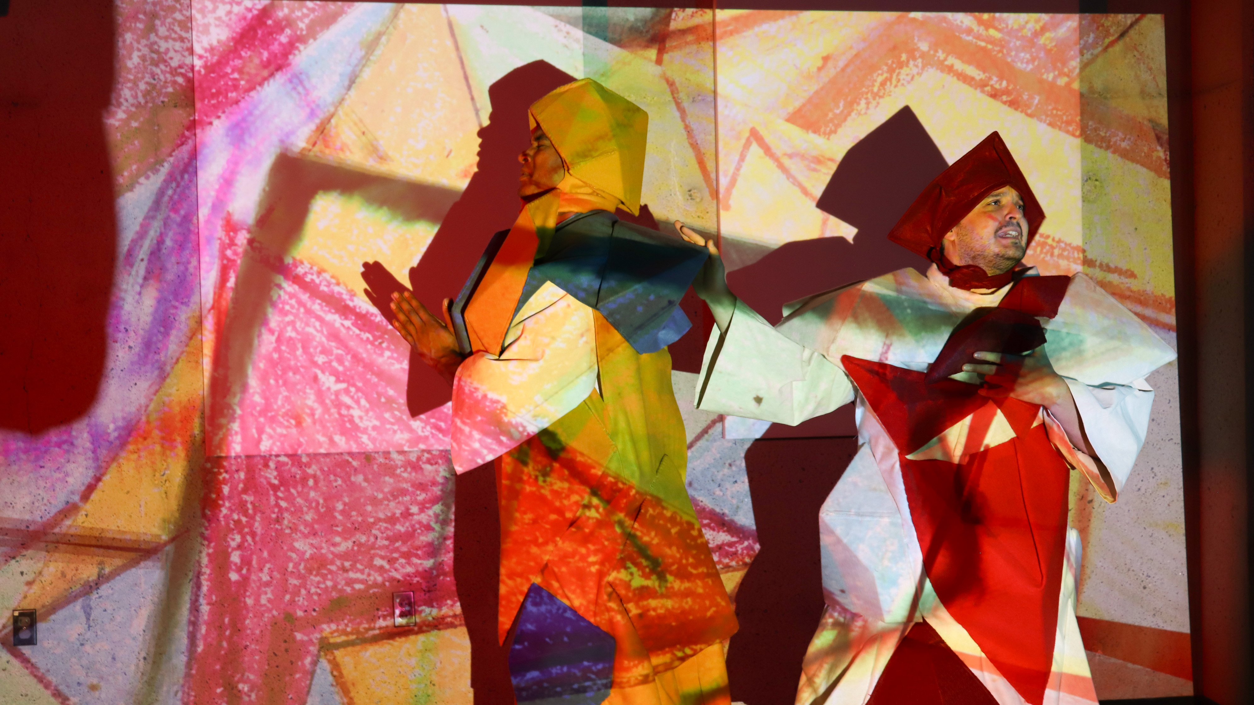
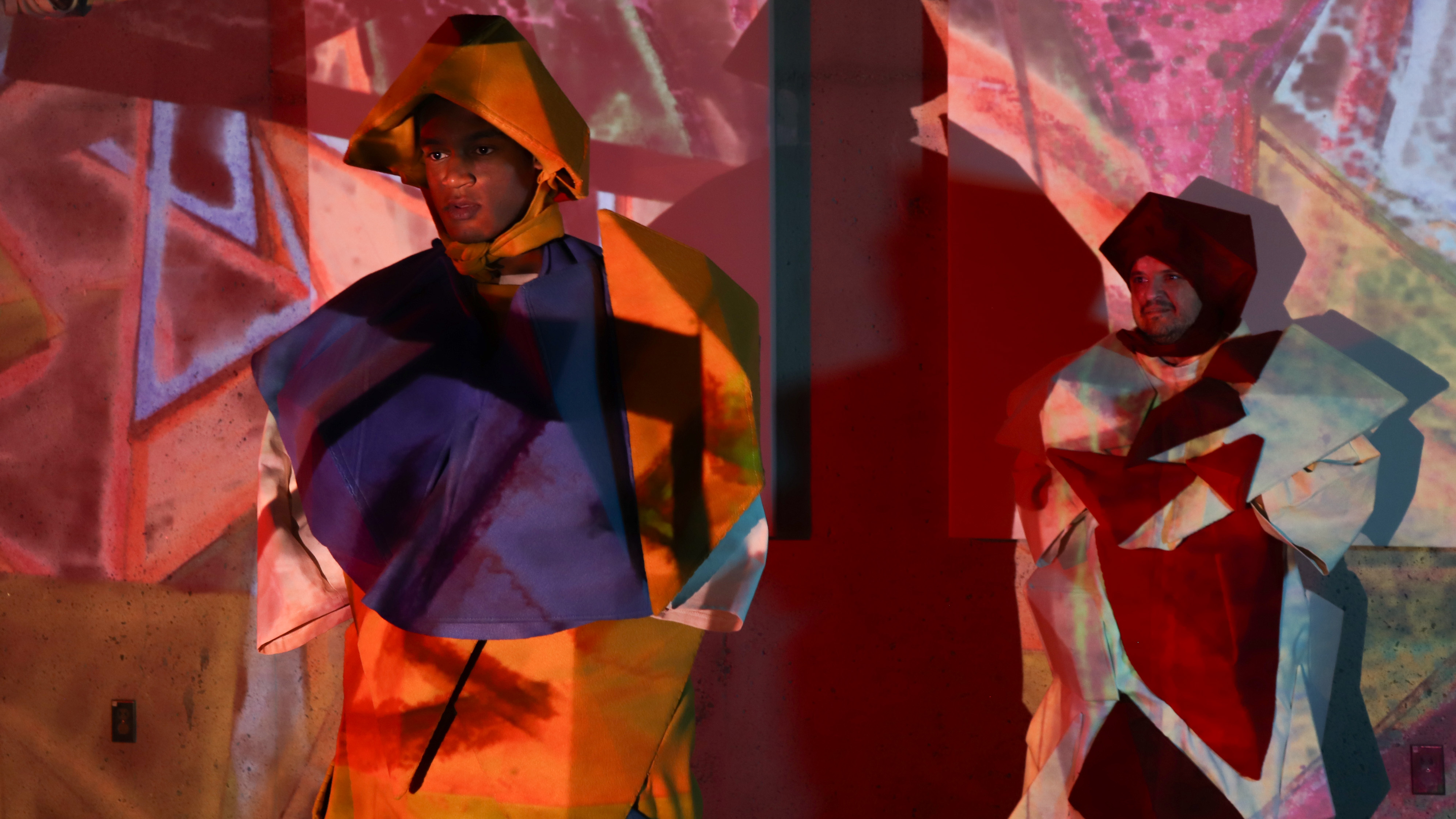
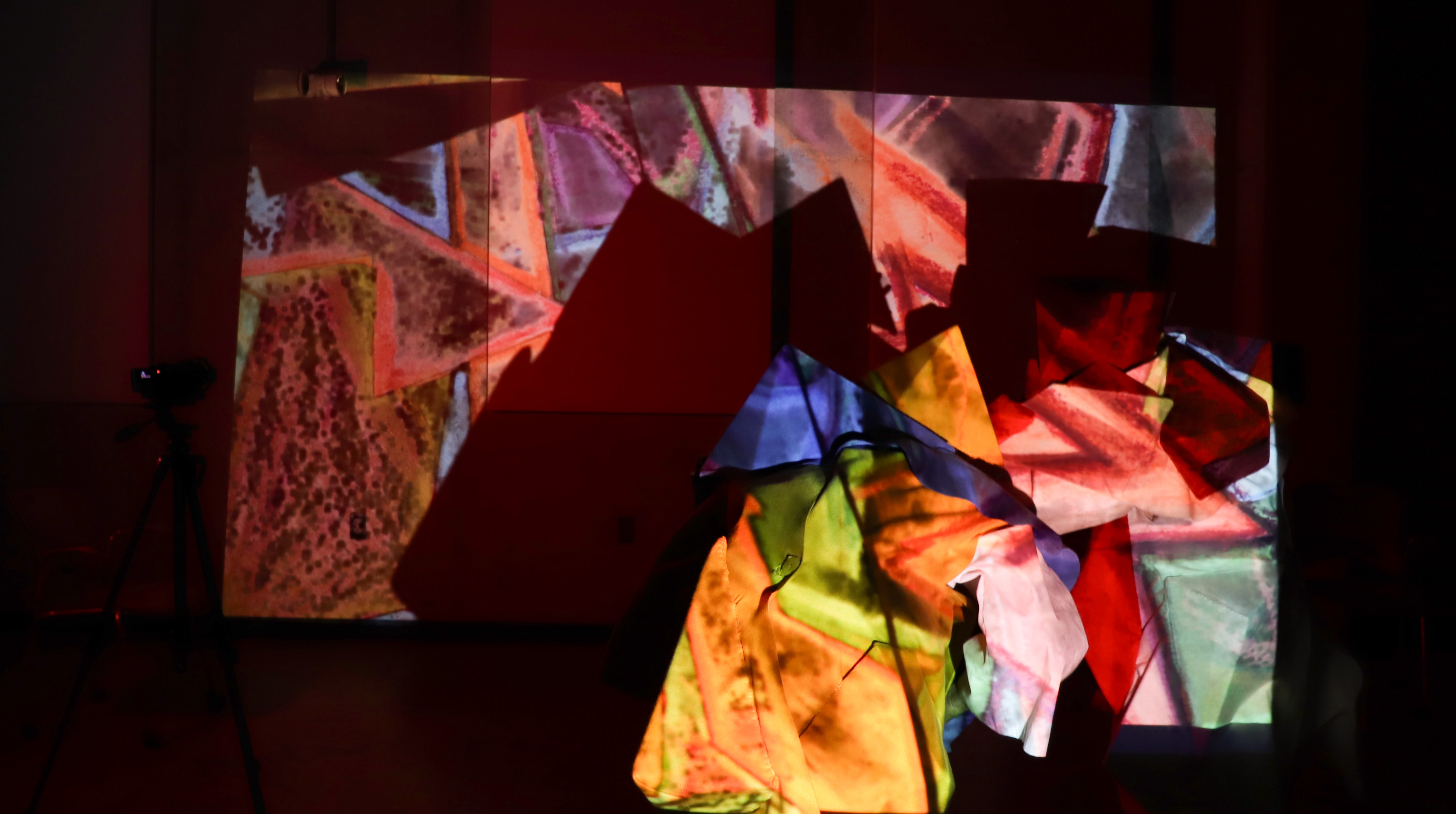
The 13th Chair, A Multimedia Experience, 2025
A collaborative exhibition and performance with Sean Lopez and Rori Smith. The exhibition is a multimedia installation with video projection, sound, handmade props, and custom painted backdrops, custom made costumes. On view at Ruffin Gallery, University of Virginia, October 2025. Preview images only.


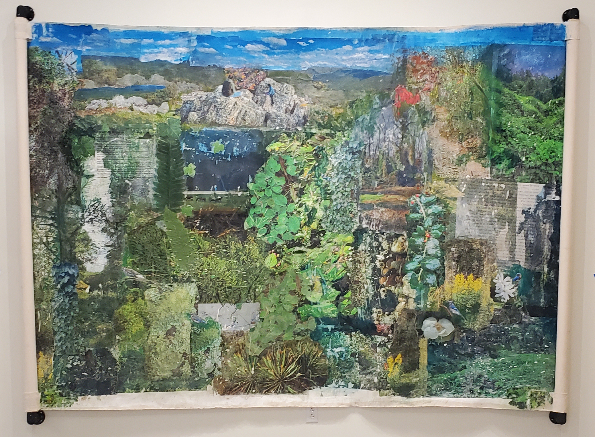
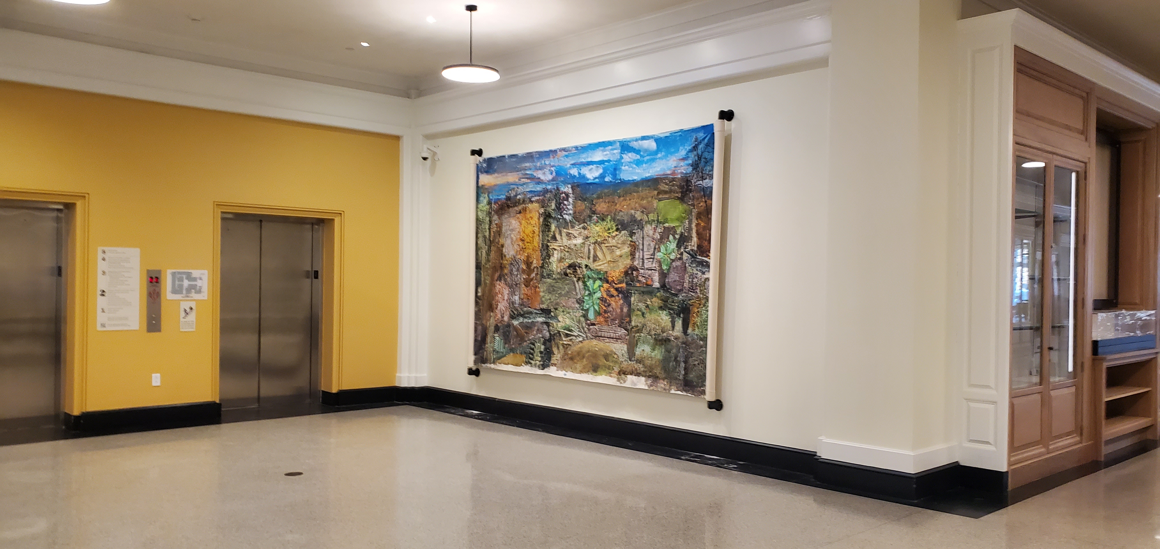
Free to Be, a Collective Virginia Landscape, 2025, Shannon Library, University of Virginia
Installation at Shannon Library at the University of Virginia, installation view. A collection of image transfers onto gessoed canvas, acrylic, watercolor, and coloring pencils. All images are from the state of Virginia during different times during the year of 2024. Installation from January-December 2025.

My Pet Islands, 2024
A video art piece examining the commodification of land and the privilege of ownership.
“Pet Islands” presents a commentary on the privatization and commodification of land in our society. Through the performance of “owning” and “domesticating” miniature island dioramas, I explore the absurdity and violence inherent in claiming exclusive rights to pieces of the Earth. The work confronts the reality that land ownership is a privilege reserved for the wealthy, while the majority must content themselves with borrowed, rented, or temporarily purchased time with land and nature.
In Progress: Un-Earth, virtual reality sculpture park.
This work is being created in Unity, (a video game engine). I used 3D scanned objects as well as appropriated models. It centers around the idea of access to exhibition space, nature, and large etherial objects. When navigating the space in game mode, the viewer will encounter several pit stops with visual installations. As the viewer approaches an installation, it will prompt sound relating to that specific pit stop.
Topographic paintings exploring texture and color. In-progress
The paintings are layered with oil paint. The paintings have been repurposed as topographic paintings. They were originally landscape paintings of various places in Texas.


Dye Sublimation on various materials
Experiments with photography, digital imagery, generative imagery, and dye sublimation on canvas and carpet. Some scenes depict landscapes of rural Western New York, however, they have been abstracted using open-source software that affects the placement of the pixels on the canvas.


SubTerrain, Virtual Reality
In this project, I am investigating the Texas geologic landscape through immersive experiences. I used Unity, 3D scanning, photography, and other software to create a simulated 3D rock garden which allows us to look into a rock or be part of a rock. The environment is a simulated underground that allows floating rocks and crystals to come together in a type of dance or mating ritual to create new rocks that merge with the viewer.


Influenced by the Northeast Landscape.
For The Forest is a series of video works that reflect on observing the forest in rural New York. The videos depict water running through rivers, creeks, and streams combined with still photography of small towns and mundane imagery. The videos are then processed by combining pixels of color with movement of water. The result is a moshing of data and pixels that makes the viewer question their own interpretations and perceptions.
Northeastern Landscape, Abstract – Subtract – Detract
This work explores the landscape of the Northeast seen through the blending of a single image with movement of background landscapes. These are the first explorations of moving images influenced by the rural landscape of the state of New York. I used image sequences processed through EbSynth, a beta software that mimics handmade painting animation.
Ofrenda, Map #1
The following set of images is part of a series titled, Ofrenda: walking drawings. An ofrenda is an offering or a gift as a thank you for a blessing received often made in religious practices. In reflecting our limitations and benefits of Covid-19 pandemic, as well as achieving the goal of receiving a Master Degree in Art, I made this work as a form of repaying a debt or a promise I made when I left Mexico in hopes of a better life. I promise to do a pilgrimage from my home village in Guanajuato, Mexico to the San Juan de los Lagos Cathedral in the same state. I promised to walk 120 miles. I decided to expand on this concept and research mark-making and non-traditional map-making.
These maps describe part of my ofrenda. I walked 15 miles each day and documented the journey to make a visual map of my walk in the city of Denton, Texas. The images are transferred onto canvas and reworked with pencils, markers, acrylic, and pastels.


Ofrenda, Map #2
Map made by walking 20 000 steps, infused with plants and flowers, embossed by the ground soil and grass. 36 yards of paper.
The process consists of walking on the paper back and forth, counting each step to 20 000. In the process, I collected flowers and plants from the same area. The flowers varied from purple, yellow, and white iris, grass, dandelions, meadow garlic, and soil.


Ofrenda, Map #4
Map created by walking on it for 20 000 steps, transfer paper marks. 36 yards of paper.
As I walked back and forth on the piece of paper, my footsteps transferred to the second layer of paper and made distinctive marks, as well as tears and rips.


Ofrenda, Map #5
Maps made by walking 10 miles over a soccer field and recorded on GPS. Drawing by a pen plotter on paper infused by fresh cut grass collected from the lawnmower.
My attempt was to create a drawing that I didn’t have to draw myself, or even attempt to draw without actually drawing by hand. These are the paths recorded by the Google Maps app.


Ofrenda, Map #7
Map made by walking over a plot of land for 50 miles for a few consecutive days. Image recorded with a drone.
With this work, I was exploring mark-making with my body onto the land itself. The paths on the land act as a connection between myself and the land, this way, this small piece of land will remember me and I will remember it. After completing the project and working so closely with the land, I feel that we built a relationship, a friendship.


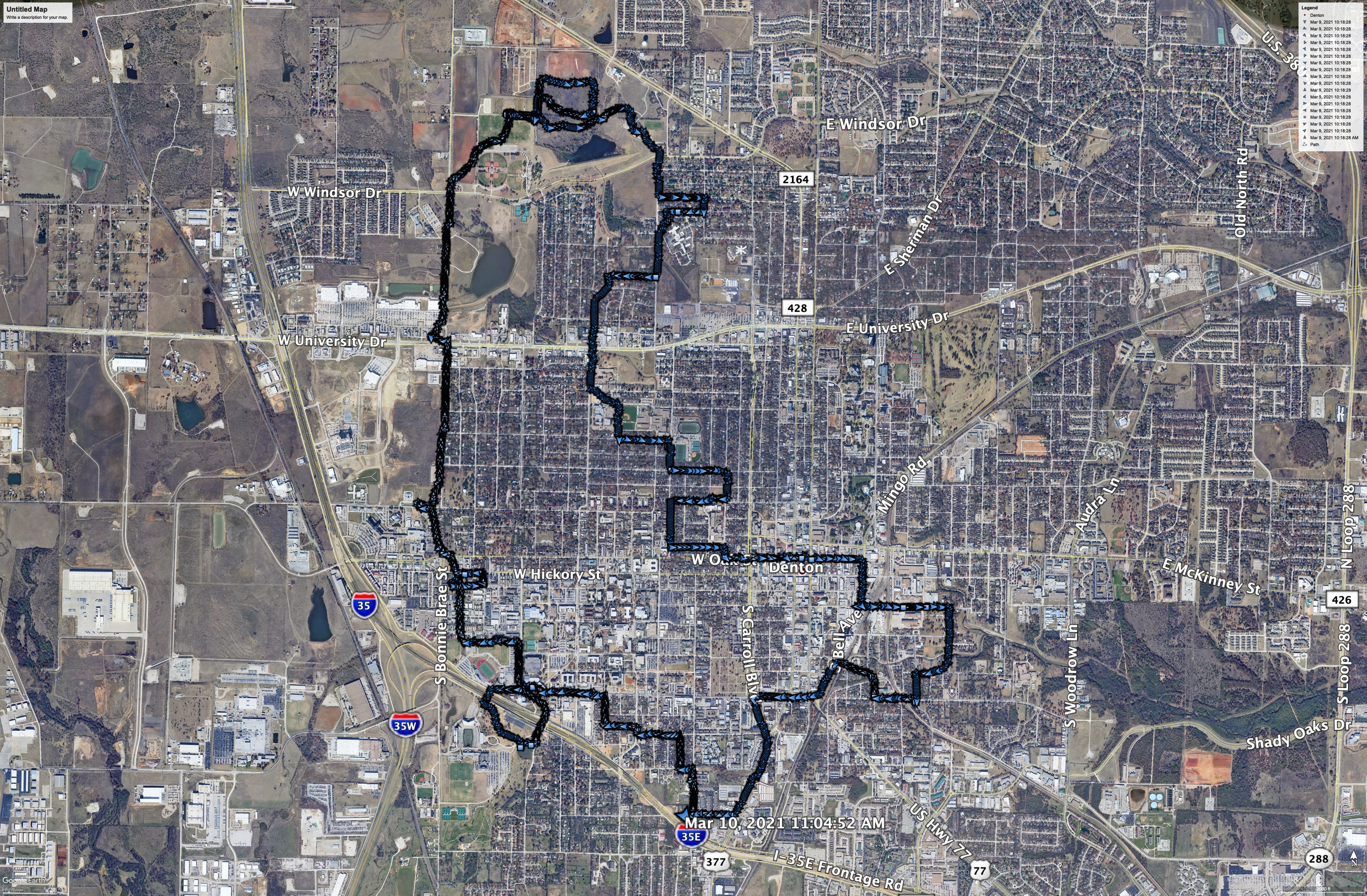
Urban Walks
A series of maps made by walking in various neighborhoods in the Dallas-Fort Worth metroplex in Texas. GPS tracking and data visualization. Exploring urban development.
This project delves into the idea of temporarily becoming part of each neighborhood and exploring urban design on foot. I used GPS tracking to map out my walks, drawing while walking. I later transferred that data to Illustrator and designed maps as a series.


Site-Specific Sculpture Installation
A series of site-specific sculpture installations in the Dallas-Fort Worth Metroplex involving urban development and public land management.
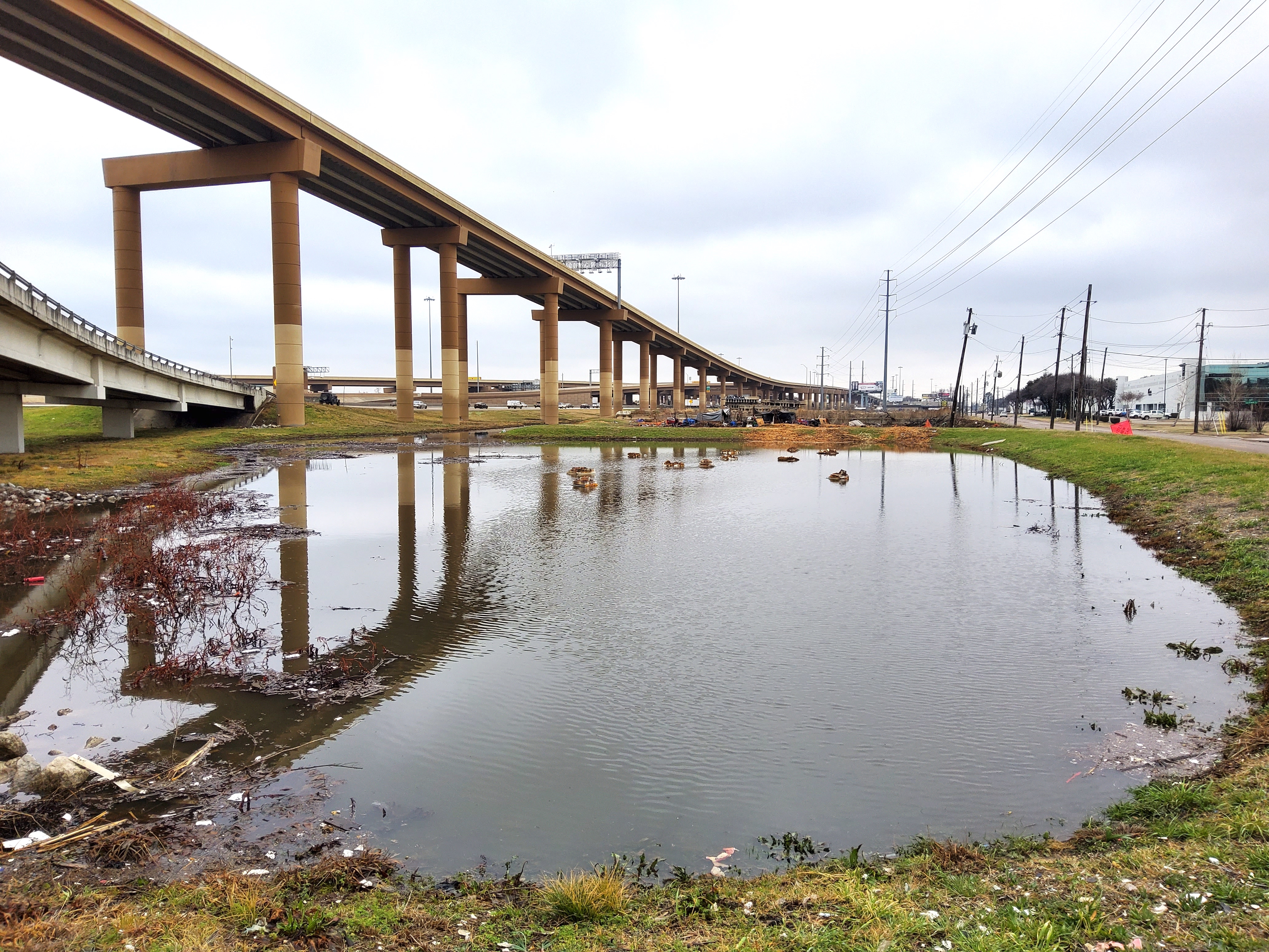
Sometimes Islands, soil, discarded foam, rope. Dallas, Texas, 2020. In this sculpture installation I explore the marginalized and forgotten pieces of land that function as support for larger structures such as the interstate highway and other major intersections.
This specific section of IH-35 and I-635 is one of the busiest stretches of roads in the Dallas-Fort Worth metroplex, all hours of the day and night. The area floods regularly with seasonal rain and it collects a variation of trash and discarded items. I encountered a large amount of foam of all types. I used these pieces of foam as a base for the terrains so that they float when the area floods. The terrains are tethered to the ground with a chain. The purpose of the tether is to prevent it from being washed away with the current in the case of a heavy rain and strong current as the are connects via a creek to the Trinity River. The soil was gathered from public lands in Texas in 2019/2020. The Terrain brings a healing element to the area and it presents itself as an ideal, or the idea of a pure place for the polluted overpass pool.


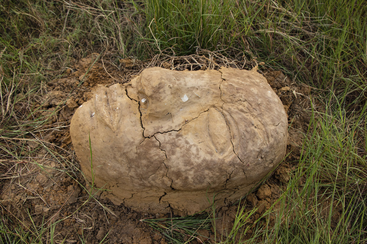
Human / Nature
Site-Specific Sculpture Installation, soil, trash, plants, Denton, Texas, 2020.
Human / Nature was made on a small forgotten piece of land connected to IH-35, a major freeway in the U.S. that runs through the entire country, north to south. The small plot of land is owned by the Texas Department of Transportation. It is not maintained or cleaned, it collects all sorts of trash throughout the year. In this piece of land, I installed six, human-head-shaped sculptures that were to be documented from above. The heads are made with soil and trash collected from the same area.
In this work, I attempt to initiate conversations about human and nature relationships. I ask questions such as, who owns the land? Who takes care of the land? What does the land say?